Several geography revision grids have been well received on Twitter recently. An example is shown below.
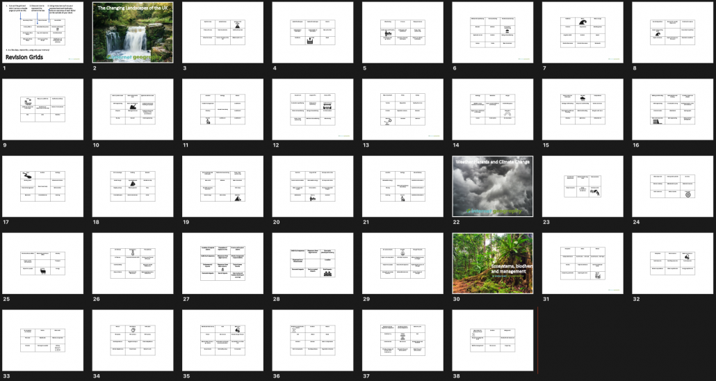
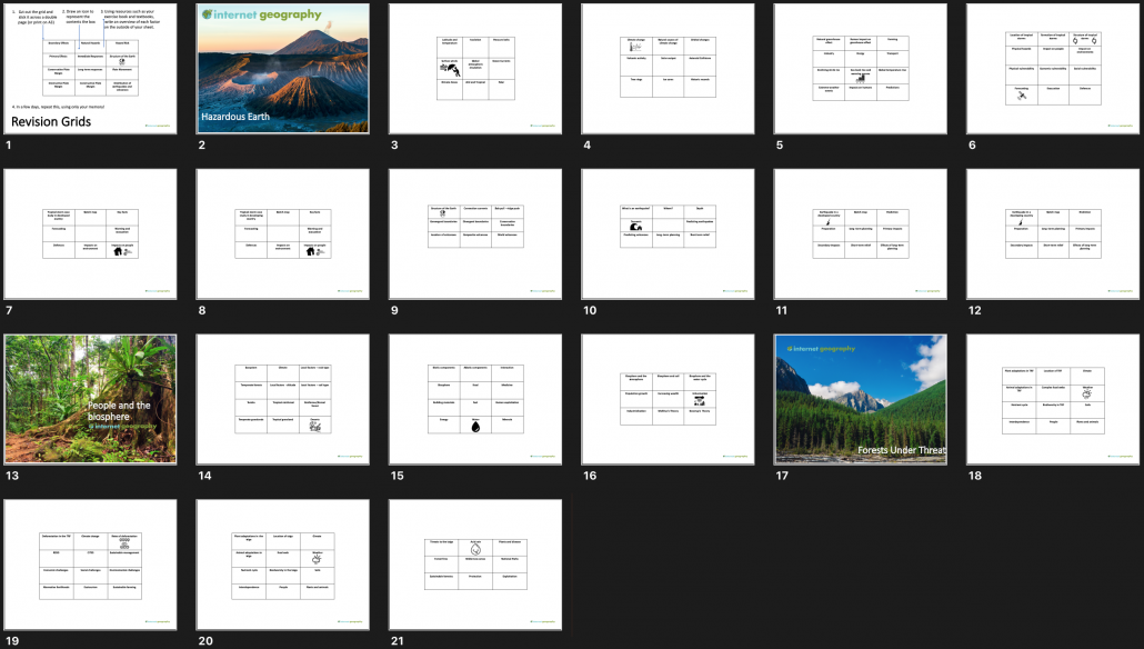
To support teachers we’ve put together a set of revision grids for AQA GCSE Geography paper 1, Edexcel A Component 1 The Physical Environment and Edexcel B, Hazardous Earth, People and the Biosphere and Forests Under Threat.
AQA GCSE Geography Paper 1 Revision Grids
Edexcel A GCSE Geography Component 1 Revision Grids
Revision Grids Set A Edexcel B GCSE Geography
You can download each set of revision grids in PDF format for free below:
Geography teachers are amazing creatures. They are talented, intelligent, attractive and funny, so what do you buy the person who has everything? Worry not, we’ve put together a list of must-have gifts for the geography teacher in your life.
1. Stocking fillers
This reusable coffee cup, made from recycled plastic, is ideal for geography teachers on the go!
Another great Christmas present for the geography teacher in your life has to be a drone. If your budget is tight considered a tello drone or if you want to splash the cash consider a DJI Mavic Pro 2. The newly released, mid-budget, Mavic Mini is also worth a look!
4. Ordnance Survey Puzzle Tour of Britain book
Cheap, cheerful and guaranteed to keep them occupied, the new Ordnance Survey Puzzle Tour of Britain Book will keep them quiet during the festive period.
5. Ordnance Survey Colouring Book
For the more creative geography teacher treat them to an OS map colouring book. If you need to, throw in some colouring pencils. Just make sure they don’t go over the lines and the shading is in one direction.
6. Ordnance Survey OS Maps online subscription
A subscription to OS Maps will win the heart of the geography teacher who loves the great outdoors. They can plan routes online, check them out in 3D and use their mobile phones to stay on the right path in the great outdoors. Of course, don’t bother if you’re after losing them! Find out more about OS Maps online subscription.
7. A good read
We’ve compiled a list of books that should be on every geography teacher’s bookshelf. Take a look at our favourite reads.
8. A personalised OS Map
The Ordnance Survey offers a personalised map service. Focus on their favourite area or create a unique gift with folded, flat or framed maps. Show the instantly recognisable style of the OS Explorer and OS Landranger leisure maps.
9. Anemometer
Sit and watch them blow it until they’re blue in the face. If it’s peace and quiet you are looking for, look no further than an anemometer.
10. Geography Teacher Mug
Perfect for break-time refreshments, treat them to a mug
11. Tooth Brush Holder
Finish off their bathroom with the perfect toothbrush holder
12. Gin
What more could the gin-loving geography teacher want? Yes, you guessed it, more gin! Mother’s ruin will help them plough through marking on an evening. Take a look at these craft gins.
13. Beers
Let them travel the world with their taste buds. Beer Hawk has put together a great collection of world beers. Staying closer to home you won’t go wrong with Marston’s classic ales.
14. Geography Stationery
Who doesn’t love a bit a nice stationery? Throw in a geographical theme and the geography teacher in your life will love it. You might consider:
16. Globe Drinks Cabinet
The best of both worlds! Drinks + globe = happy geography teacher. Treat your geographer to a globe-shaped mini bar drinks cabinet
17. A GPS Device
18. T-shirt
Geography teachers are loud and proud about their subject. Help them shout about it with a geography-related t-shirt.
19. An anorak
Ok, walking jackets are a lot more sophisticated now than they were in the past. Why not look after them and keep them warm with an insulated coat or dry with a waterproof jacket.
20. Virtual Reality
A VR headset will get them turning heads (sorry, that was shocking). A VR headset combined with a smartphone and Google Earth VR puts the whole world within their reach.
https://www.internetgeography.net/wp-content/uploads/2018/11/Inspiration-for-Christmas-gifts-for-geographers.png6701200Anthony Bennetthttps://www.internetgeography.net/wp-content/uploads/2024/01/Internet-Geography-Logo.pngAnthony Bennett2019-12-08 17:10:542019-12-08 22:07:17What do you buy a geography teacher for Christmas?
This is the twelfth collection of useful tweets relating to #geography and #geographyteachers. The world of Twitter can be a busy place so I’ve pulled together some tweet treats from the last week that are worth having a look at. Tweets are in no particular order.
A useful strategy for re-visting learning. This example is for RE but could be easily adapted for geography. Miss Lyons has been kind enough to share this resource on Internet Geography.
Can’t remember who posted this resource but thank you very much for doing so! Some students were in an exam today, this activity was a great way to catch up on what we had learned about the final topic before picking it back up again. #edutwitter#Retrieval#GCSEREpic.twitter.com/QmXKcqmv2O
Earlier I posted a photo of an origami Christmas tree using old map extracts – @GeoBlogs has already sorted some super easy instructions. Thanks Alan 😊
(Old books and manuscript paper work well too!) pic.twitter.com/MVV2hwXQK3
I ❤️ trying new things. Y10 and 8 have been busy creating summary grids on identified misconceptions. This resulted in fantastic results with 5 year 8s gaining 100% in their quiz 😁. Future Geographers 🌍 #geographyteacher#geography#revisionpic.twitter.com/xCDklNTg5q
We’re loving this independent study guide for a-level students.
#socedchat#socsup
Some of my year 12’s a really struggling with the idea of consolidating on their learning as we go so I have created this to help them.
These knowledge test retention resources look superb.
I’ve changed the format of our knowledge tests that we use regularly in lesson as extended starters. Tests knowledge retention and produces ideal revision sheets for students! Blue pen and feedback in lesson to minimise written feedback #geographyteacherpic.twitter.com/GqLiSyKY37
These retrieving and learning physical features using longitude and latitude resources look great!
New #geography Region Study of #Africa. Retrieving & learning physical features 4 ways of places we will ‘visit’. Lat & long location based on ‘name’ place in atlas. Any ‘must haves’ I’ve missed? Base map from pinterest + additions pic.twitter.com/JFD5iW583F
GCSE map skills with a twist 🗺 I created this lesson for an obs today and it was brilliant! Ss were really engaged and produced some excellent work 🙌🏻 Happy to share. #geographyteacherpic.twitter.com/RKIQLZsxli
This is the eleventh collection of useful tweets relating to #geography and #geographyteachers. The world of Twitter can be a busy place so I’ve pulled together some tweet treats from the last week that are worth having a look at. Tweets are in no particular order.
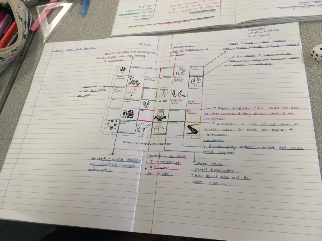
You can download Kirstie’s living world revision grids here on Internet Geography.
The Challenge of Natural Hazards Monopoly! Hoping Year 11 will find this useful for a nice little recap next week!🌪️Hopefully it goes down just as well as the Changing Economic World one🌍 #LoveASequel#GeographyTeacher#RQTpic.twitter.com/GytJ4jjm6t
Changing Places Knowledge Organiser completed for Year 12! One down, three to go!! Quite pleased with how its turned out if I do say so myself!! #geographyteacherpic.twitter.com/c4roIi1Jwg
Ben, thank you again for your contribution. I am picking up globalisation with my A level class after Christmas. Just lightened the Christmas holiday planning for me! Awesome work. #HowIteach#geographyteacher
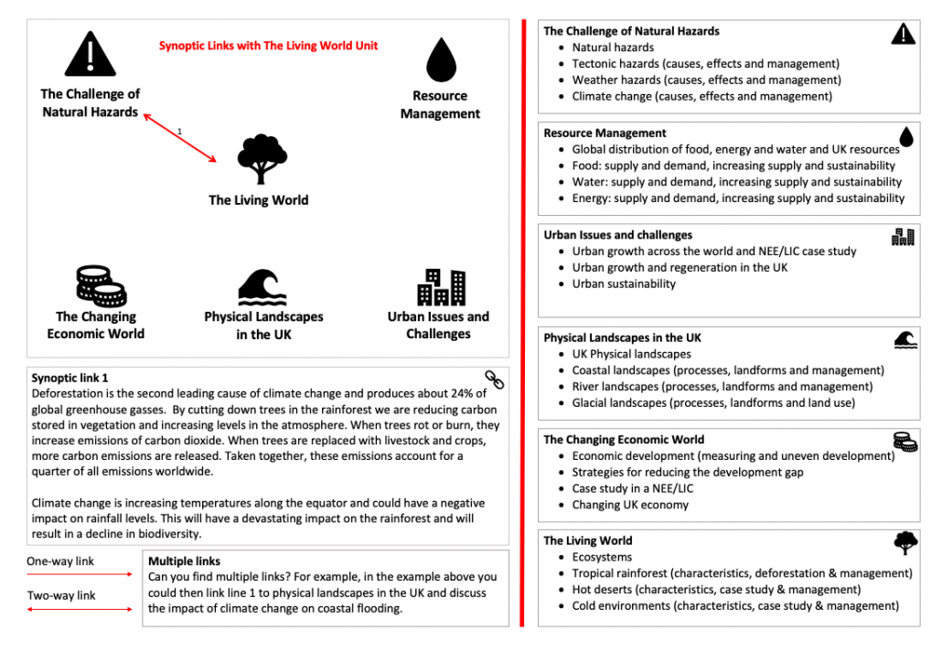
The aims and learning outcomes of the AQA GCSE Geography course focus heavily on students thinking, studying and applying like a geographer. This includes students making links and applying their knowledge to a range of real-world contexts.
The Assessment Objectives in geography clearly reflect these aims and learning outcomes. AO2, for example, involves students demonstrating an understanding of the interrelationships between places, environments and processes. Also, AO3 covers the application of knowledge and understanding to make judgements. Combined, these two assessment objectives account for up to 70% of the assessment weightings in the AQA GCSE Geography course.
Therefore, it is critically important, not just in creating good geographers, but also in raising achievement that students develop the ability to make synoptic links in geography. Some students will have an innate ability to think like a geographer and make connections in the world we live in. However, others will need support in developing their ability to do this.
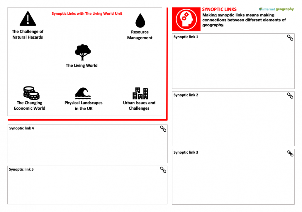
The document below encourages students to connect their learning to the wider world. The example covers the synoptic links that exist between The Living World unit and the other main units in the AQA GCSE Geography specification. This could be used once the Living World unit has been completed, using the additional guidance on the second page to support, along with a textbook. Alternatively, it could be used once all the major units have been completed as a summary revision activity.
Synoptic Links Revision Activity
The students draw lines representing synoptic links between The Living World and other units. An example of this is shown below. Students should be encouraged to further develop links that address multiple units.
Recently Kirstie Bowden (AKA @kirstiebowden) posted a revision grid covering AQA Geography The Living World, inspired by history teacher Amanda Raddon (@AJRRaddon).
Kirstie has kindly agreed to share these resources on Internet Geography. Kirstie has also provided the instructions for using the resource. You can download these below:
Josh has kindly agreed to share these on Internet Geography for anyone to download. These are currently available in MS Published format. We are working on other formats and will make them available very soon!
Be sure to show your appreciation to @Geog_HA on Twitter or in the comments below!
This is the tenth collection of useful tweets relating to #geography and #geographyteachers. The world of Twitter can be a busy place so I’ve pulled together some tweet treats from the last couple of weeks that are worth having a look at. Tweets are in no particular order.
Inspired by @WilkesHistory I've created a few 8 page booklets which the pupils LOVE! So far I've used them for the formation of dryland features & the characteristics and formation of volcanoes. One pupil hoped to do a David Attenborough style voiceover! #geographyteacherpic.twitter.com/R6vdzmJ269
Misconceptions? Who you gonna call? Geography Myth Busters!
I recently asked geography teachers for the most common misconceptions that crop up in the classroom. As usual, the geography teacher community came up trumps with lots of suggestions. To return the favour, I’ve collated some of the most common misconceptions and created a pack of A4 posters to download for free.
The resource can be used in a range of ways. Here are some suggestions:
display one a week and have a competition to encourage students to explain why it is a misconception
distribute them to your class and get them to prepare a presentation as to why it is a misconception
put up on your classroom wall and use them as a discussion point
add a QR code that links to a web page that busts the myth so students can find out why its a misconception
If you have any other ideas to share or if you think we’ve missed a common misconception leave a comment below!
Download the PPT presentation containing the posters below (32MB).
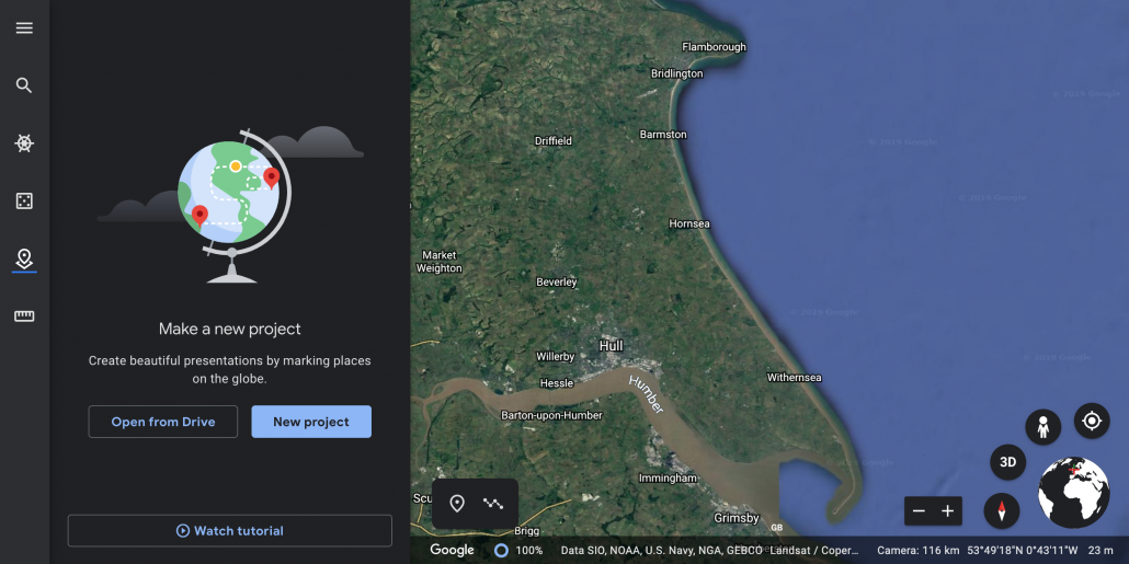
Google Earth has recently launched creation tools allowing you to create stories and maps. Having had a play with the new feature I have to say it’s fantastic. Not only can stories and maps be shared with others to view, but you can also collaborate on the same map in real-time. You must use the Google Chrome browser to access Google Earth online.
Having followed the tutorial below, Louise Hayne has kindly shared two amazing Google Earth case studies covering the 2011 Sendai, Japan earthquake and the Haiti earthquake. Give Louise a follow on Twitter via @louhayne1.
The software is very intuitive and many features can be worked out through having a play. However, I’ve put together a step by step guide covering some of the main features for those who feel less confident about using GIS software below.
Introduction to creation tools in Google Earth
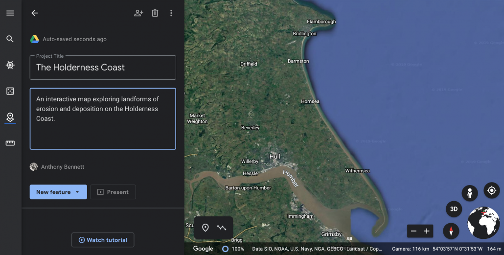
Open Google Earth online using Google Chrome. Click the New Project icon
Google Earth – Step 1
Give your project a suitable title and description
Google Earth – Step 2
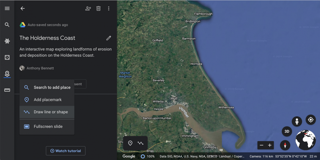
Click new feature > draw line or shape.
Google Earth – Step 3
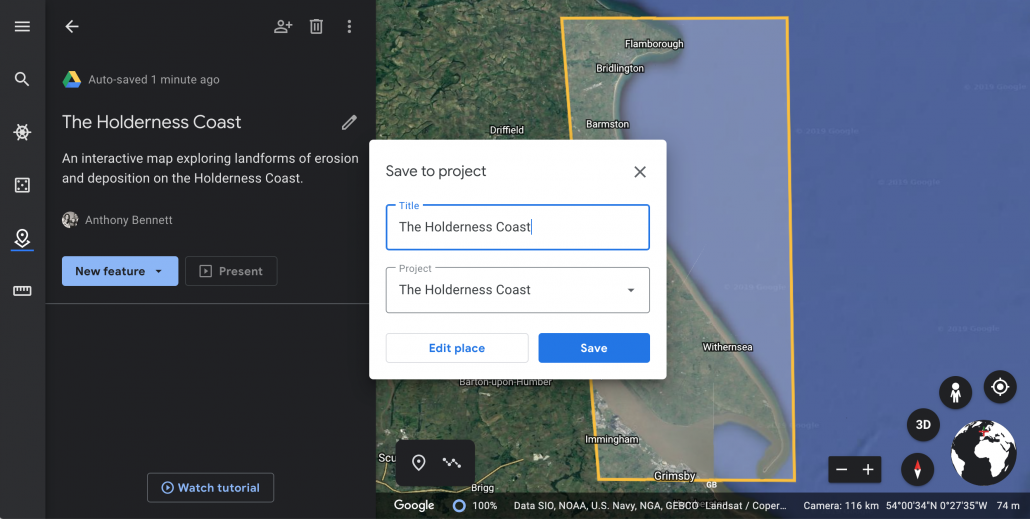
Draw a shape around the case study area. Give it a title.
Google Earth – Step 4
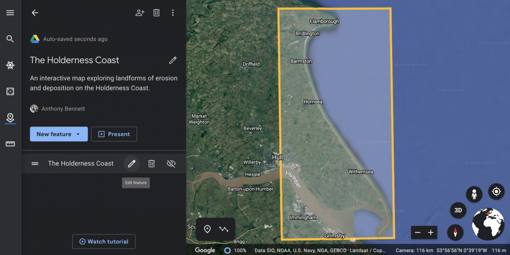
Click edit place to tidy up the shape.
Google Earth – Step 5
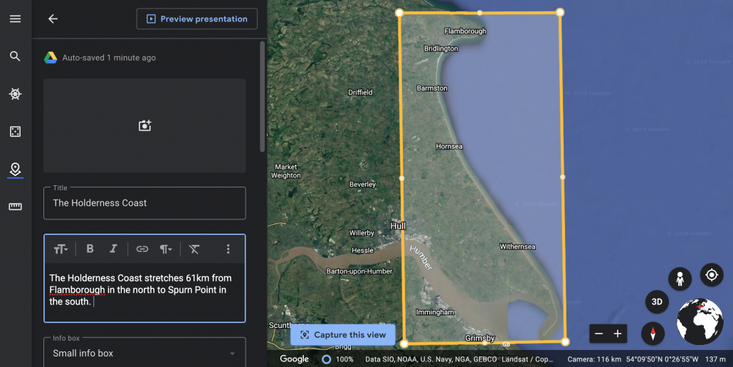
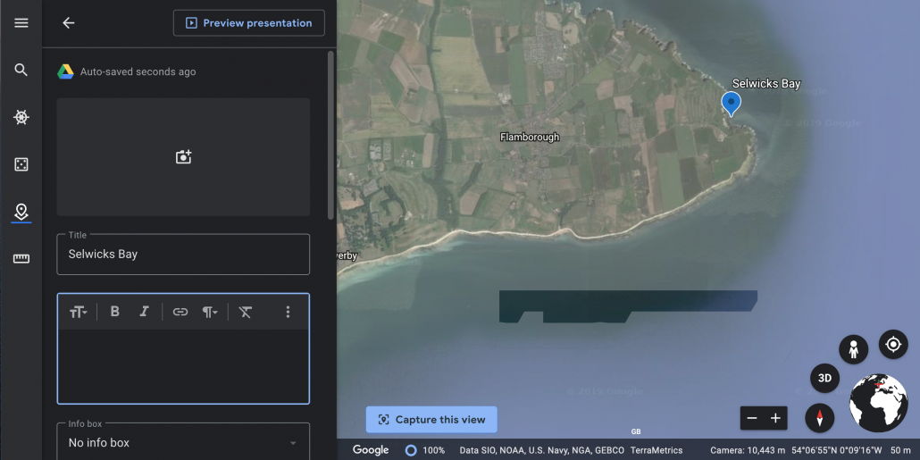
Add a description and click the Capture this view icon so whenever someone clicks the location it will zoom to this view.
Google Earth – Step 6
You can also add an image by clicking the camera icon. When you’ve finished click the back button in the top left corner.
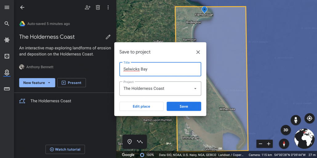
Next, start adding place makers for different locations by clicking the New feature button and selecting either add placemark to add the location manually or search to add place.
Google Earth – Step 7
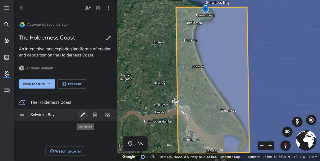
Once you’ve added your placemark you can edit is by hovering over the location in the menu on the left.
Google Earth – Step 8
Click the pen icon to edit.
Google Earth – Step 9
Zoom into the location to move the place marker into a more accurate position. Drag and drop the place marker to move it.
Google Earth – Step 10
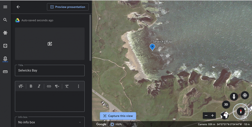
You can zoom closer to the location and change the default view.
Google Earth – Step 11
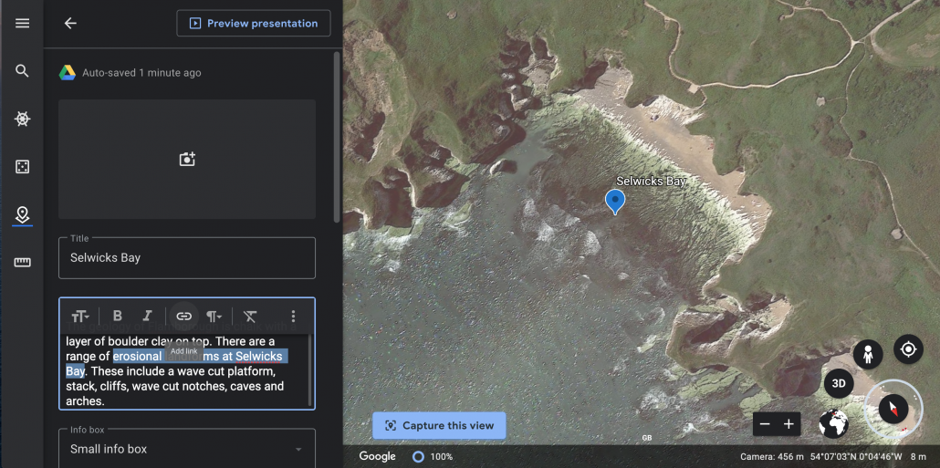
To do this zoom in then click the compass icon. You can now change the viewing angle by using the enlarged compass icon. When you are happy with the view click Capture this view.
Google Earth – Step 12
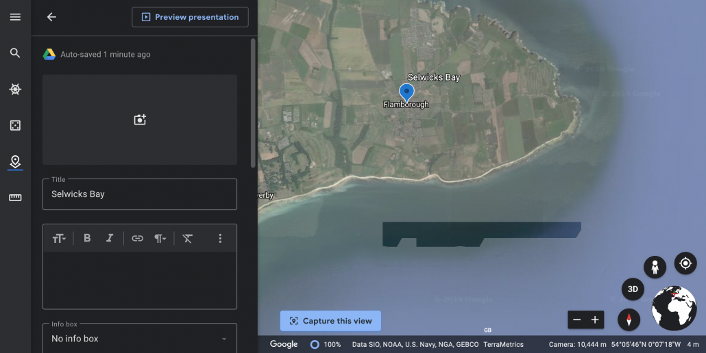
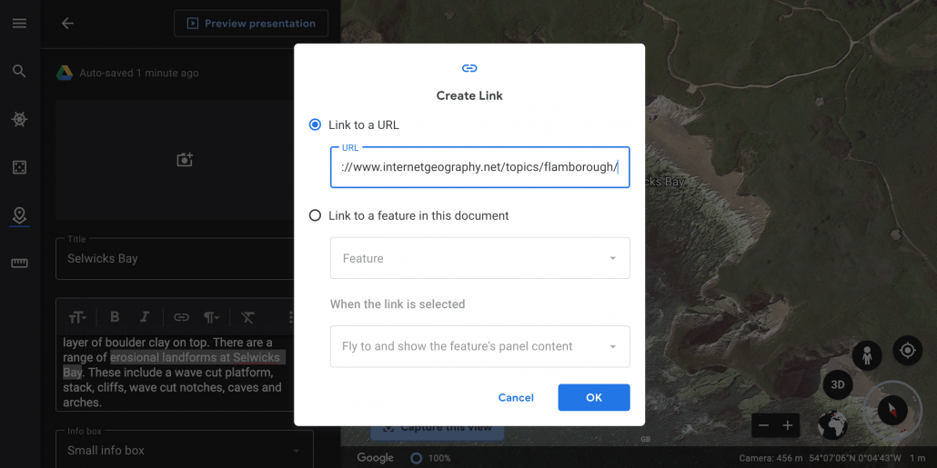
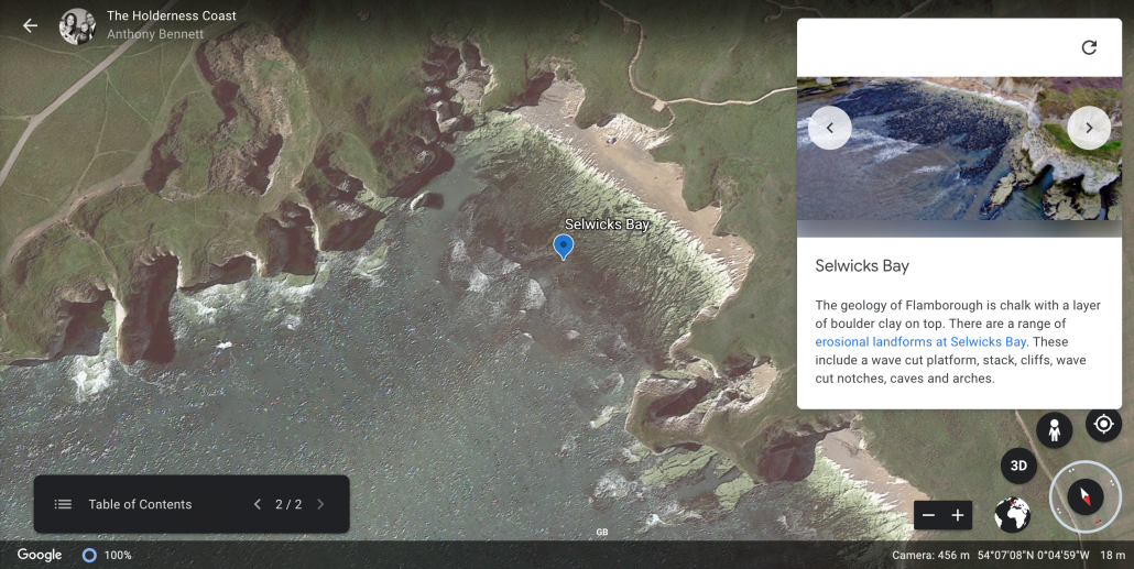
You can add links to the text you include in the description. Highlight the text you want to become a link and click the link icon. In this case, a link has been included to more detailed information about landforms of erosion at Flamborough on Internet Geography.
Google Earth – Step 13
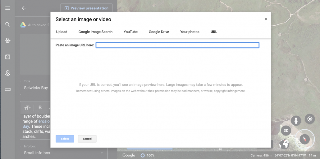
Adding an image is easy, simply click the camera icon and choose the source of the image you want to use. Multiple image can be included.
Google Earth – Step 14
You can review your presentation at any time by clicking Preview presentation.
Google Earth – Step 15
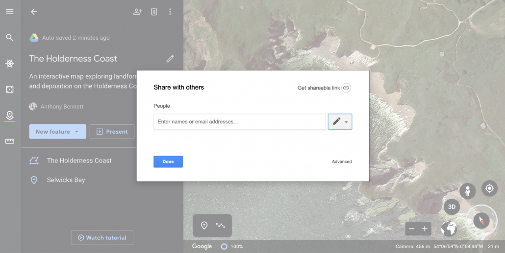
By clicking the share button you can share your map. When you share you can choose to either allow people to view or edit. By allowing people to edit the map you can collaborate on the map with other people at the same time!
Google Earth – Step 16
It’s also possible to embed 360 images from Google Maps into your stories and maps. The video below explains how to do this!