How does global atmospheric circulation determine the location of arid and high-rainfall areas?
Edexcel B GCSE Geography > Hazardous Earth > How does global atmospheric circulation determine the location of arid and high-rainfall areas?
Global atmospheric circulation is a key factor in determining the climate of different regions worldwide. By understanding how this system works, we can explain why certain areas experience arid conditions with high pressure while others have high rainfall with low pressure. This guide will explore the mechanisms of global atmospheric circulation and its impact on climate patterns.
Global atmospheric circulation refers to the large-scale movement of air that redistributes heat and moisture around the Earth. It is driven by the sun’s uneven heating of the Earth’s surface, which creates pressure differences that cause air to move.
The three-cell model of atmospheric circulation helps to explain the movement of air in different parts of the world. It consists of three primary circulation cells in each hemisphere: the Hadley Cell, the Ferrel Cell, and the Polar Cell.
Atmospheric pressure is the force exerted by the weight of the air in the Earth’s atmosphere on a given surface area. It is measured in units of millibars (mb) or inches of mercury (inHg). Atmospheric pressure varies across different regions of the Earth and is influenced by factors such as altitude, temperature, and the presence of weather systems.
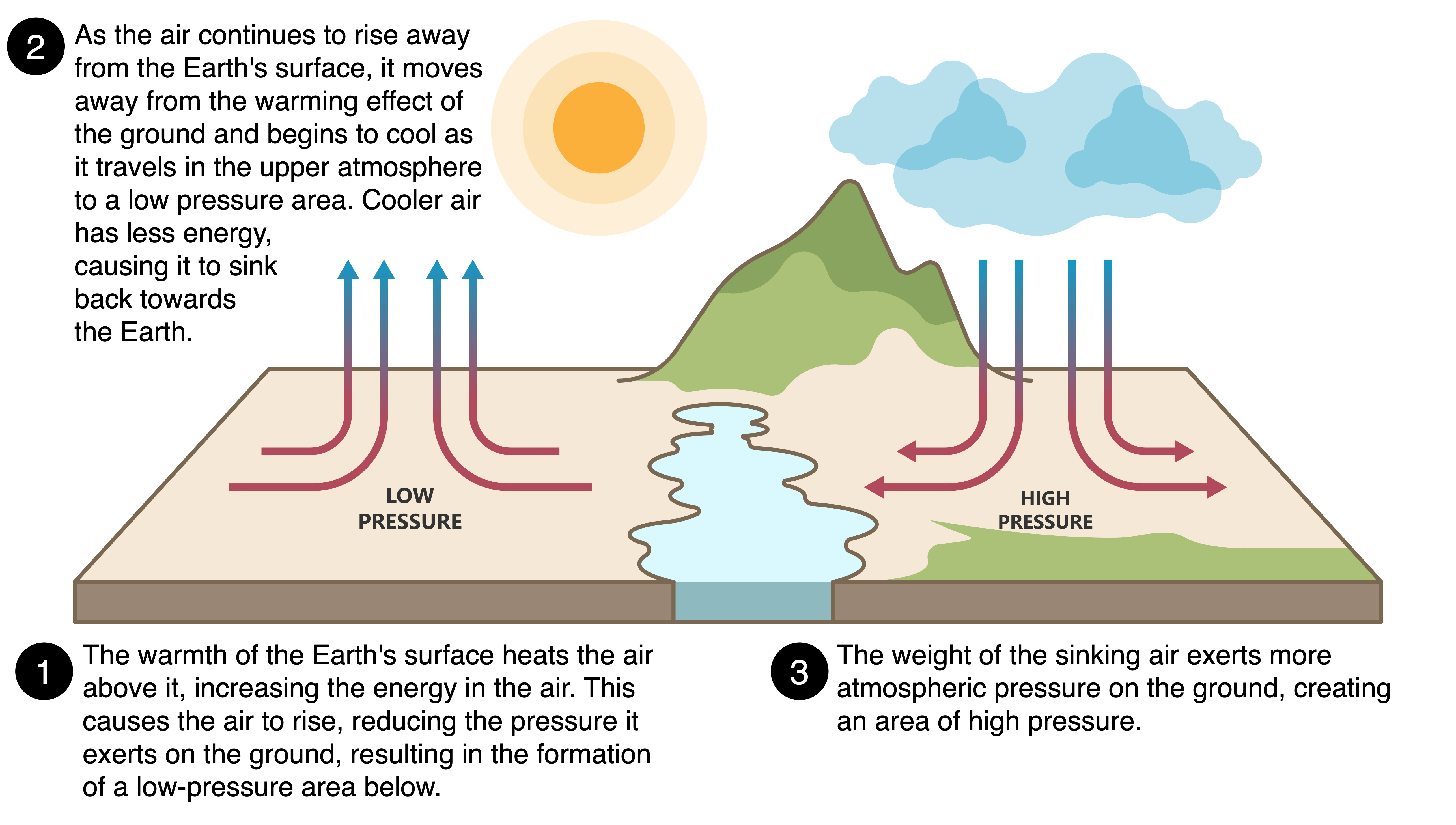
Atmospheric Pressure
High atmospheric pressure, often called a “high-pressure system,” occurs when the atmospheric pressure at a location is higher than its surrounding areas. High-pressure zones are associated with descending air that inhibits cloud formation and precipitation. These areas are typically found at around 30° latitude north and south of the equator.
Low atmospheric pressure, or a “low-pressure system,” occurs when the atmospheric pressure at a location is lower than its surrounding areas. Low-pressure zones are associated with rising air that cools and condenses to form clouds and precipitation. These areas are typically found at the equator and around 60° latitude north and south.
The Coriolis effect, caused by the Earth’s rotation, influences the direction of wind flow within the atmospheric circulation cells. It causes moving air to be deflected to the right in the Northern Hemisphere and to the left in the Southern Hemisphere, contributing to the trade winds, westerlies, and polar easterlies.
Coming Soon
Coming Soon