
Field Sketches in Geography
What is a field sketch?
Put simply, a field sketch is a simplistic drawing of a particular location (not just a field!). Field sketches are a useful form of qualitative data.
When is using a field sketch appropriate?
Field sketches can help us to remember the places that have been visited and are useful for recording observations and measurements. They are also a useful way of identifying, describing and explaining characteristics of places. They are also useful ways of interpreting photographs that are taken in the field.
How do I produce a field sketch?
Field sketches can be drawn by anyone – fantastic artistic skills are not required. Drawing a field sketch is a straightforward process:
Step 1
Identify the landscape that needs to be sketched. In this example, the image below will be used.
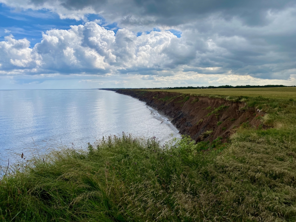
The view south of Mappleton
Step 2
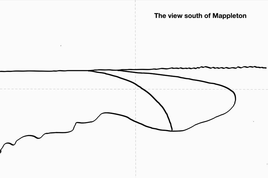
Write a title that will help to locate the sketch, eg ‘Site One’. Divide your page into 4 using feint lines to help get the scale of the picture right.

Step 2 of Creating a Field Sketch
Step 3
Draw in the skyline and foreground in your field of view.
Step 3 of Creating a Field Sketch
Step 4
Draw an outline of the main features of the landscape with a pencil, eg hills and valleys or buildings and roads.
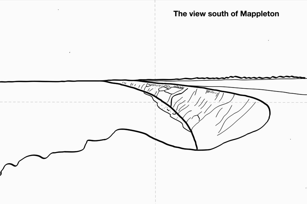
Step 4 of Creating a Field Sketch
Step 5
Add further detail to the sketch to record more information. Only draw people if they are important to the enquiry question.
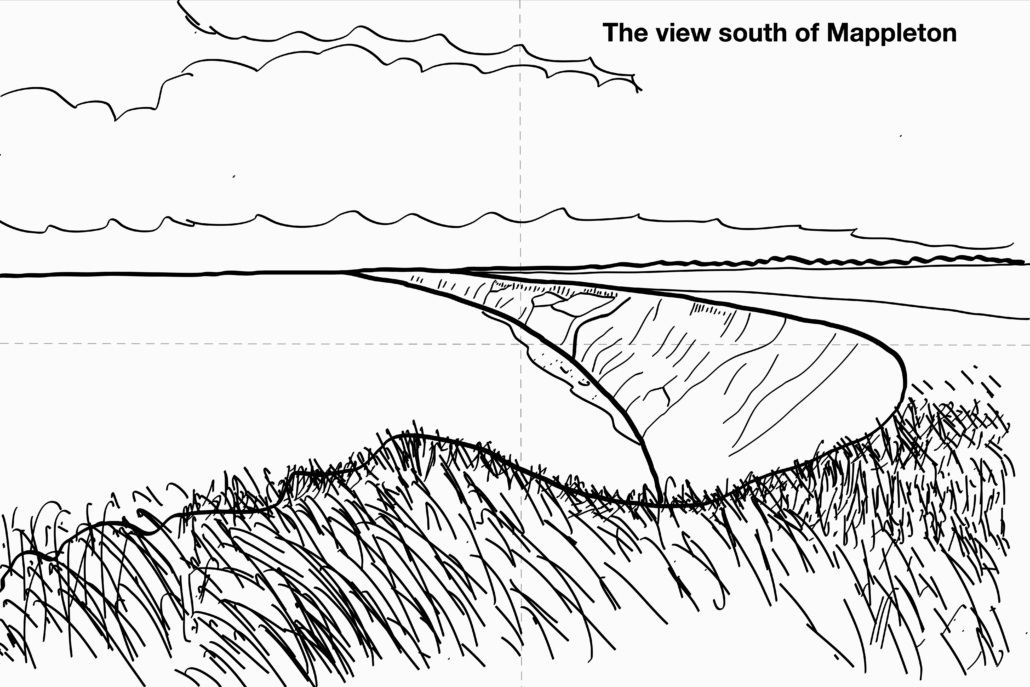
Step 5 of Creating a Field Sketch
Next, you will either label or annotate your image. The examples below show the difference between labelling a field sketch and annotating one.
Labelling a field sketch
Labelling a field sketch involves identifying the main geographical features at the location. Labels should be connected to each feature using a line.
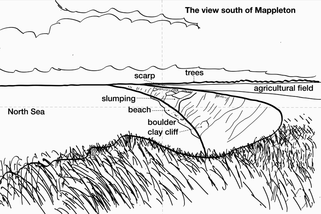
Labelling a field sketch
Annotating a field sketch
Annotating a field sketch involves adding explanations of the geographical features in the sketch. A line should be used to connect the explanation to the feature.
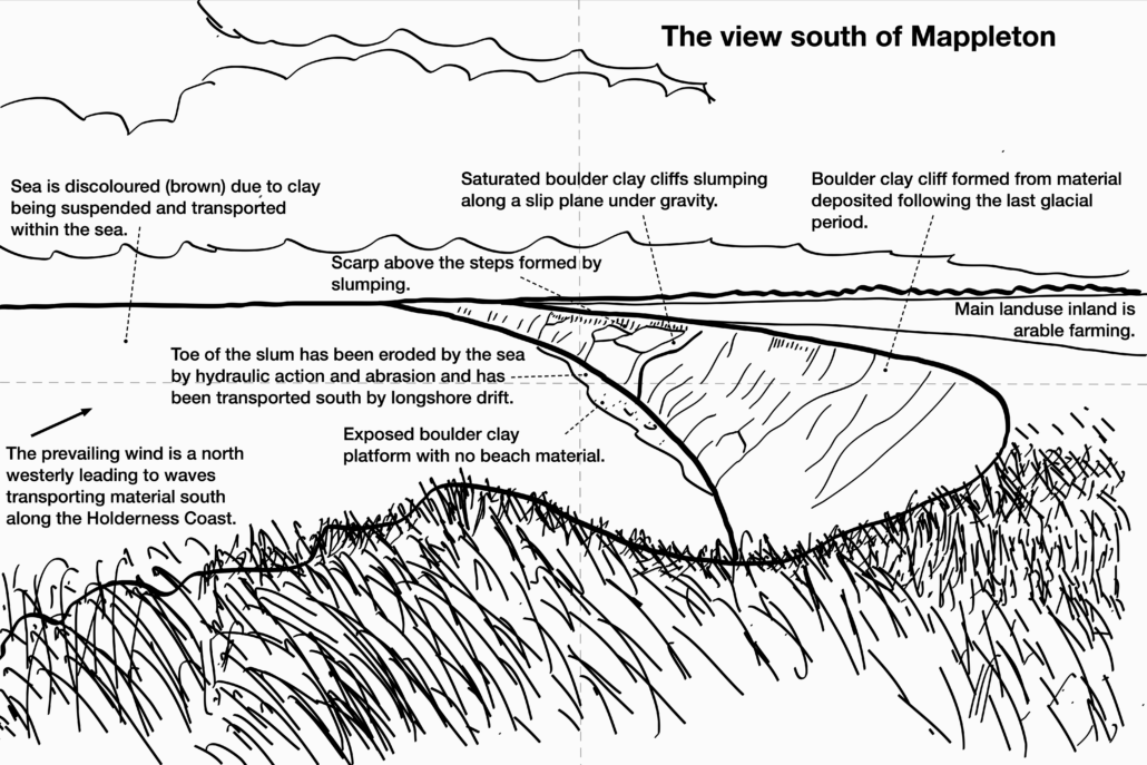
Annotating a field sketch


Data Presentation Techniques in Geography
Use the images below to explore related GeoTopics.