How to create a cross-section using an ordnance survey map
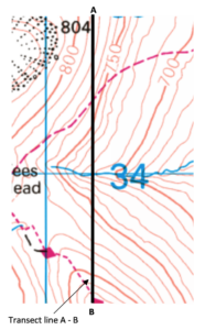
The extract from the map below includes a transect line (A-B). We are going to create a cross-section of this transect.
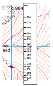
Take a strip of paper. Mark A at the start of the transect and B at the end. Place a mark where a contour line crosses the transect. Record the height. Also, mark any roads/rivers etc.
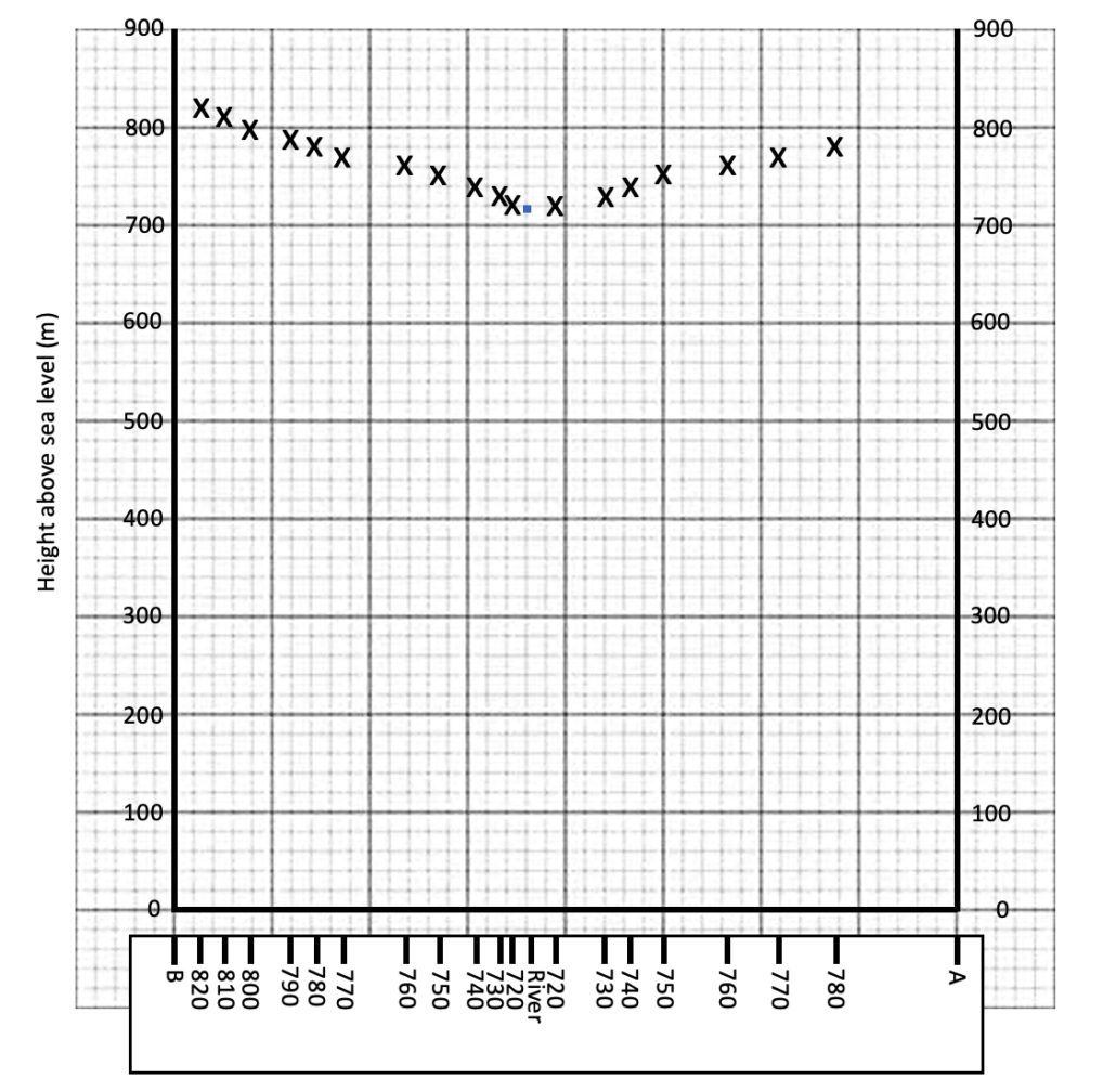
On graph paper, draw the horizontal (x ) axis, the same length as the transect, using a pencil and ruler. Check the maximum height of the contours along the cross-section, then create an appropriate Y-axis scale. Label the Y axis. Use your strip of paper to plot the heights as shown below.
Use a pencil to draw a smooth line connecting the points you have plotted.


