Skills Plus Baseline 1 Atlas Skills
If you are here, it’s probably because you need to work on some of the atlas skills covered in Skills Plus Baseline 1.
Study the information below (you might find it helpful to make notes or revision cards) and attempt the interactive activities to help improve your geographical skills.
Continents
A continent is one of Earth’s seven main divisions of land. The continents are from largest to smallest: Asia, Africa, North America, South America, Antarctica, Europe, and Australia. You can explore the Earth’s continents using the interactive map below.
Activity
Drag and drop the labels below to identify each continent.
Oceans
Historically, there are four named oceans: the Atlantic, Pacific, Indian, and Arctic. However, most countries now recognise the Southern (Antarctic) as the fifth ocean.
Activity
Drag and drop the labels below to identify each ocean.
Longitude and Latitude
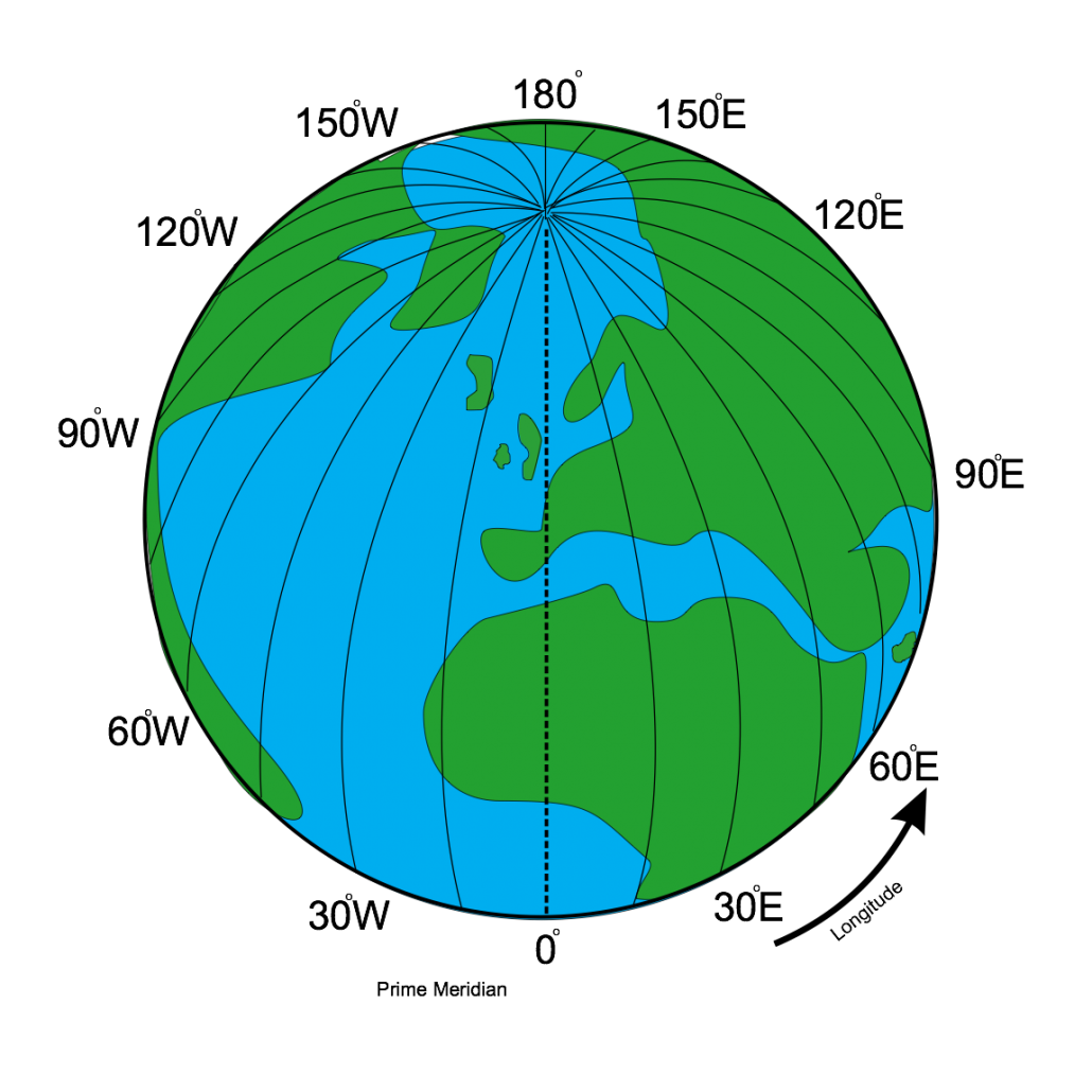
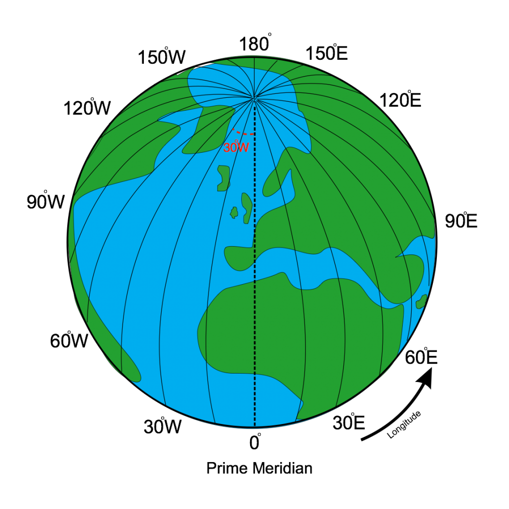
Longitude and latitude are used to locate places on atlas maps. Lines of longitude and latitude are measured using the degrees of a circle, as the Earth is a sphere.
Latitude
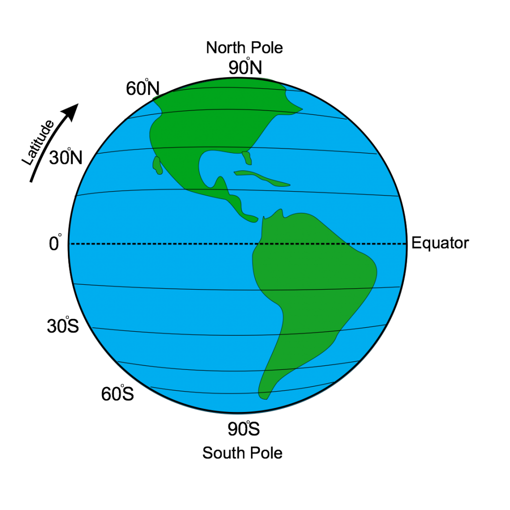
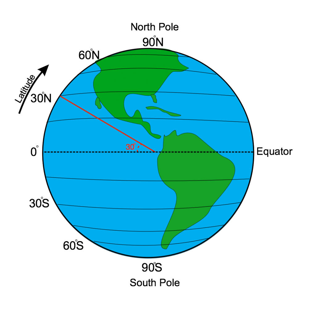
Lines of latitude are horizontal and run from east to west. The Equator is a line of latitude that lies at 0°.
Lines above the equator are shown as °N (north) and lines below are shown as °S (south). The image below shows how the line of latitude 30°N has been established.
In Skills Baseline 1, you were asked to identify several lines of latitude. Explore them using the interactive diagram below.
Activity
Drag and drop the labels below to identify the major lines of latitude.


