Sunda Strait Tsunami Indonesia Case Study 2018
What caused the Sunda Strait tsunami in Indonesia?
On Saturday 23rd December 2018 a large tsunami swept into the coastal towns on the Indonesian islands of Sumatra and Java, killing at least 429 people and injuring 1400.
Indonesia is located on the Pacific Ring of Fire which means there is a constant risk of natural disasters, such as tsunamis, volcanic eruptions and earthquakes.
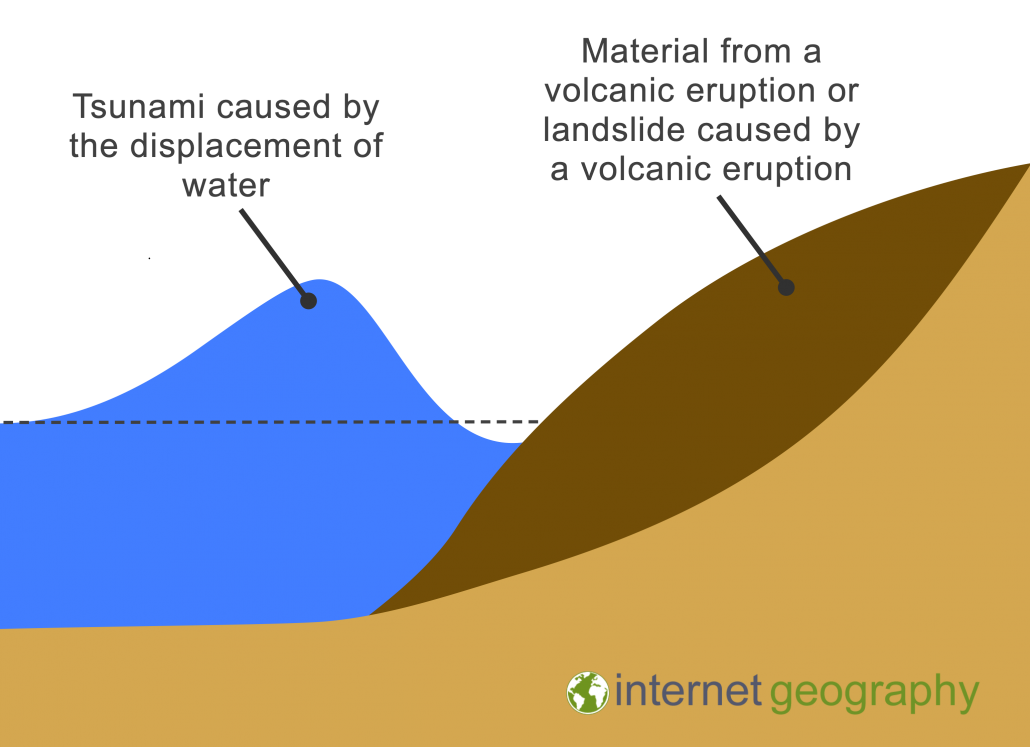
The tsunami was triggered by the eruption of Anak Krakatoa (child of Krakatoa), which set off an undersea landslide.
Mt. Krakatoa Eruption, one hour ago. Credit to Capt. Mykola from Susi Air#PrayForBanten #prayforanyer #PrayForLampung #PrayForSelatSunda #prayforindonesia #Krakatau #TsunamiSelatSunda #TsunamiAnyer #tsunamibanten #TsunamiLampung pic.twitter.com/xI2TU1ysBv
— Safiro (@hudasafiro) December 23, 2018
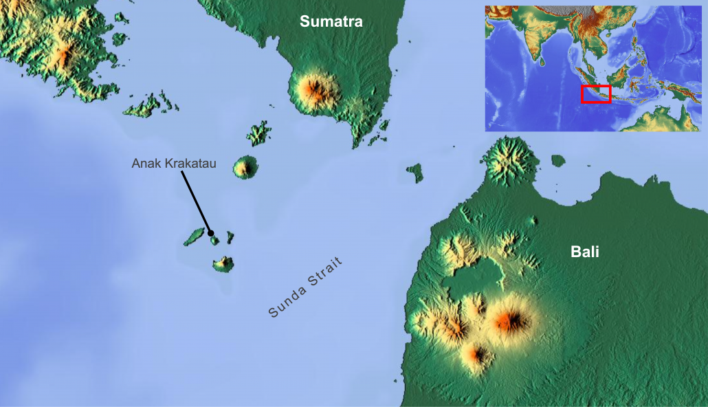
The volcano lies in the Sunda Strait between Java and Sumatra, linking the Indian Ocean and the Java Sea.

A map to show the location of Anak Krakatau
A 64-hectare segment of the west-southwest flank of the volcano collapsed into the sea during an eruption. This sent millions of tonnes of rocky debris into the sea, displacing the water, pushing out waves in all directions. What was once a volcanic cone standing some 340m high is now just 110m tall. In terms of volume, 150-170 million cubic metres of material has gone, leaving only 40-70 million cubic metres still in place.
The image below illustrates the cause of the tsunami.

Volcanic Tsunami
Volcanic tsunamis can be more devastating than earthquake tsunamis. This is because volcanic tsunamis may not trigger warning systems that are designed to alarm after large-scale earthquakes so there is little or no warning prior to the tsunami making landfall. Despite this, even if a buoy were located close to Anak Krakatoa, this is so close to the affected shorelines that warning times would have been minimal given the high speeds at which tsunami waves travel.
Like the Sulawesi tsunami earlier in 2018 the tsunami was very localised and to cover the Indian Ocean with sufficient sensors to warn against all such eventualities would require many thousand buoys on the network. In shallow water, the energy of the tsunami is quickly dispersed and so, in this case, the wave didn’t travel as far from source as the very destructive 2004 Boxing Day tsunami which occurred in the deep ocean.
At least 429 people were killed and 1400 injured. 150 people are still reported missing, and the death toll is expected to rise.
Indonesia’s disaster management agency stated 556 houses, nine hotels, 60 food stalls and 350 boats are known to have been damaged.
At least 16,000 people were displaced.
Thousands of people are living in temporary shelters like mosques of schools, with dozens sleeping on the floor.
Aid agency supported the evacuation of the injured and are providing clean water, shelter and tarpaulins. Following the tsunami, the Red Cross began preparations for the possibility of disease breaking out in the tsunami zones.
Volunteer groups cooked meals for newly homeless locals taking refuge in shelters dotted along the affected coast.
Torrential rain hampered search and rescue teams.
Rescue workers struggled to reach remote areas of the country that were hit by the tsunami.
Use the images below to explore related GeoTopics.