
Home > Geotopics > Tropical Cyclones – Source Areas and Tracks
Tropical Cyclones – Source Areas and Tracks
The area where a tropical cyclone forms is known as its source area. These source areas provide the conditions for tropical cyclone development, particularly seawater temperatures of 26.5°C or higher. Such temperatures typically reach between June and November in the northern tropics and between April and November in the southern tropics, reflecting the seasonal distribution of tropical cyclones.
Tropical cyclones move away from their source areas following the prevailing winds and ocean currents. In the Northern Hemisphere, tropical cyclones generally track westward initially. The path a tropical cyclone takes is known as its track.
As shown in the image, tropical cyclones in the North Atlantic initially move westward with the prevailing winds but often curve northwards. This change in direction occurs when winds in the middle and upper atmosphere shift, steering the tropical cyclone northward. Upon reaching approximately 30°N, the prevailing winds at that latitude may push the tropical cyclone northeast, creating a hook effect in its track.
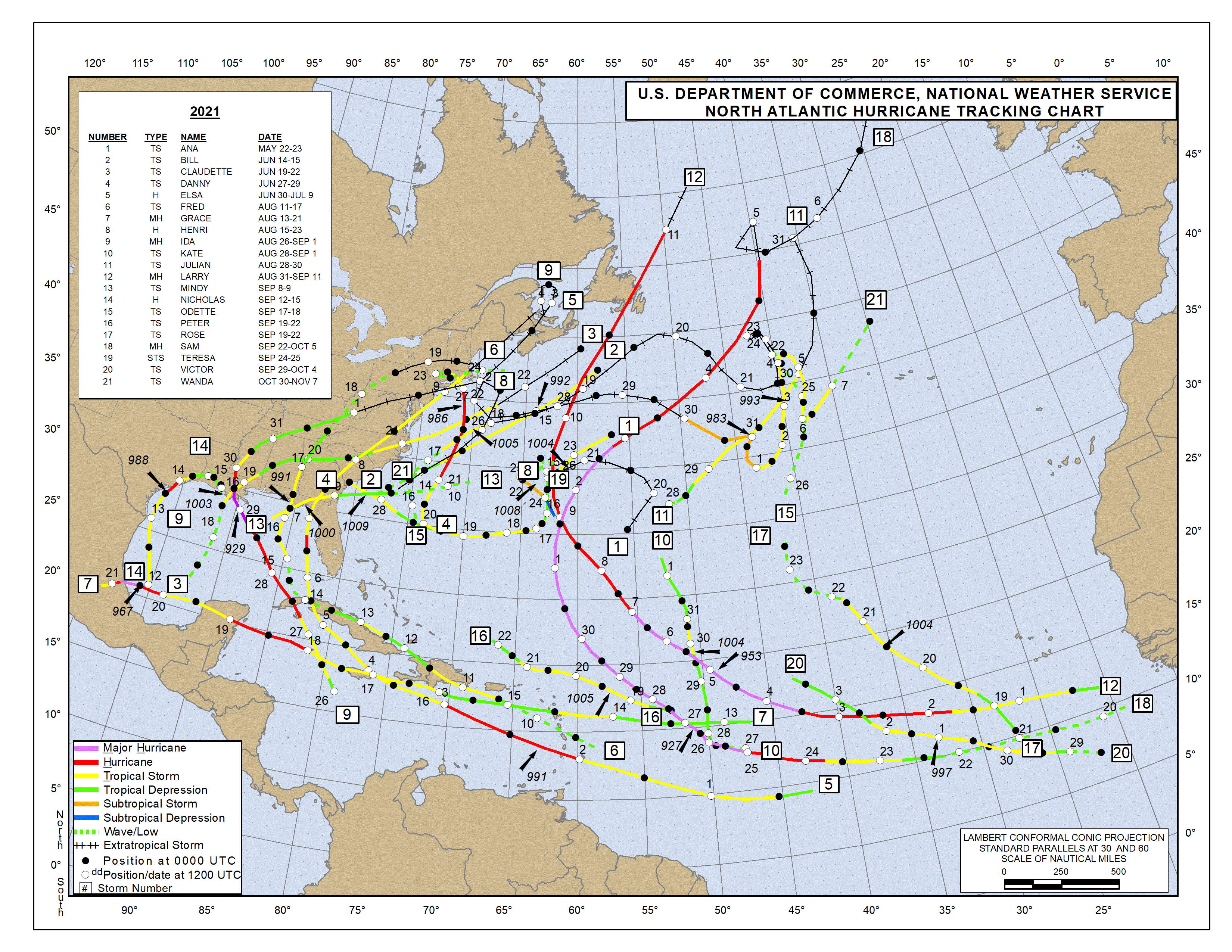
2021 Hurricane Season Tracks – Source: https://www.nhc.noaa.gov/data/tcr/index.php?season=2021&basin=atl


Related Topics
Use the images below to explore related GeoTopics.
Topic Home
Next Topic Page
Top Pages
Blog Posts
 Introduction to the AQA GCSE Geography Pre-release 20256 March 2025 - 11:38 am
- Santorini Shaken by Earthquake Swarm: Thousands Evacuate Amid Safety Fears6 February 2025 - 12:54 pm
- AQA GCSE Geography Case Studies and Examples Sheet22 January 2025 - 12:24 am
- GCSE Geography Summary Knowledge Organisers18 January 2025 - 11:32 am
- Wildfires in California: Causes, Effects, and Responses13 January 2025 - 11:46 am
- 2024: A Record Year for Wind Power10 January 2025 - 12:53 pm