What are the risks of coastal flooding?
A significant concern in some coastal areas of the UK is the risk of increased erosion and flooding. The risk is related to climate change, but in two different ways:
- the rise in sea level which threatens to flood coastal areas
- the increased frequency and intensity of damaging storms and storm surges which are capable of breaching coastal defences.
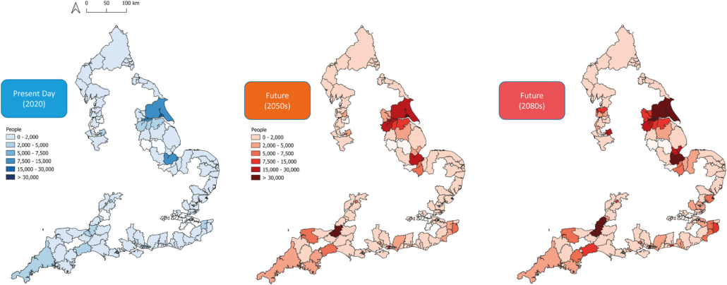
The map below shows the projected changes in the number of people exposed to coastal flooding in England.

Projected changes in people exposed to coastal flooding in England – Source https://www.sciencedirect.com/science/article/pii/S0964569122001624
How do rising sea levels increase the risk of coastal flooding?
Climate change will lead to sea-level rise. The amount sea levels will rise is unknown, but estimates suggest it will be between 30cm and 1m by the year 2100. As seas and oceans warm, water molecules expand (thermal expansion), leading to rising sea levels.
There are many locations around the world at risk of coastal flooding due to sea-level rise:
- In the UK, the East Riding of Yorkshire, Hull, Lincolnshire and London are just some of the locations at increasing risk of coastal flooding.
- Many small islands in the Indian and Pacific Oceans, like the Maldives and Tuvalu, could disappear.
- If sea levels rise by 1m in Bangladesh up to 15% of the country could be flooded.
How do storms and storm surges increase the risk of coastal flooding?
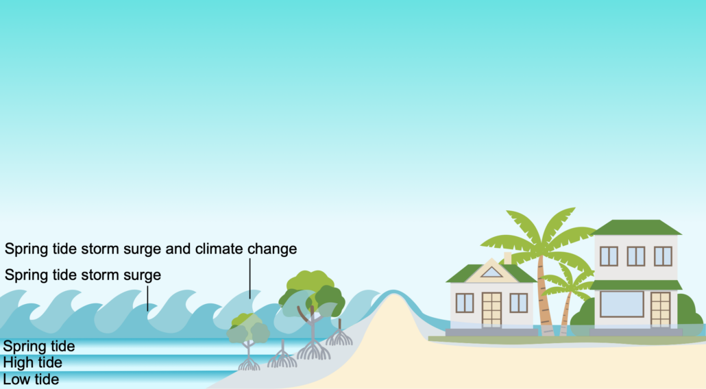
Sea levels change constantly. Due to the gravitational pull of the moon twice a day high tides cause raised sea levels.
There are two exceptionally high tides each month called spring tides. The risk of coastal flooding increases during spring tides. If spring tides coincide with large waves, the sea rises further.
Climate change is increasing the likelihood of more intense hurricanes and depressions (low-pressure systems). For every 1 millibar drop in air pressure, the sea level rises by 10 mm. A combined drop in air pressure, strong winds a spring tide increases the likelihood of storm surges.
Related Topics
Use the images below to explore related GeoTopics.


