What is a tsunami?
Tsunami is a Japanese word meaning ‘harbour wave’. A tsunami is a long, high sea wave produced by a disturbance, such as a volcanic eruption, submarine earthquake or coastal landslide.

A tsunami is a long, high sea wave produced by a disturbance, such as a volcanic eruption, submarine earthquake or coastal landslide.
Tsunamis can have heights of up to 30 m (98 ft) and reach speeds of 950 km (589 mi) per hour. They are characterised by long wavelengths of up to 200 km (124 mi) and long periods, usually between 10 and 60 minutes.
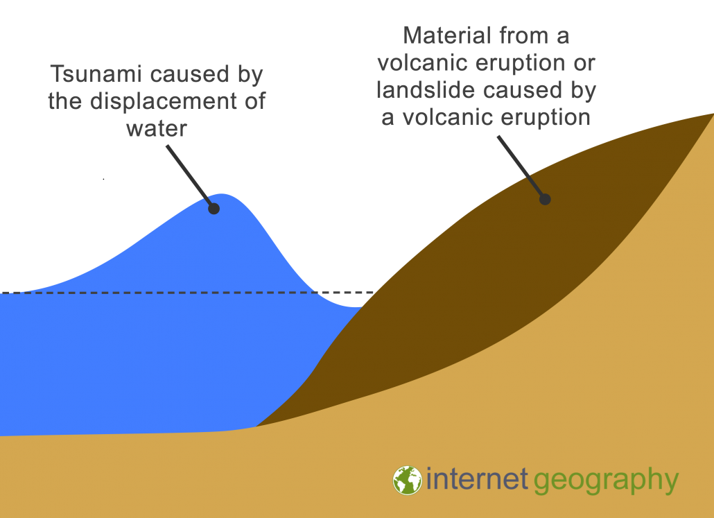
Water is displaced when an earthquake, volcano or landslide happens on the ocean floor. Displacement occurs when an object is immersed in a fluid, pushing it out of the way and taking its place.
The image below illustrates how volcanic material causes displacement, leading to the formation of a tsunami.

Volcanic Tsunami
An example of a tsunami caused by a volcanic eruption is the Indonesian Tsunami, which occurred in the Sunda Strait in December 2018. The tsunami was caused by the sudden failure in the west-southwest flank of the Anak Krakatau volcano, which was active at the time.
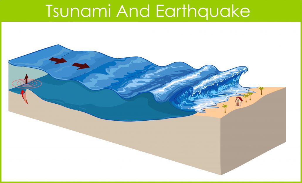
Undersea earthquakes can also cause tsunamis. However, the earthquake must be a shallow marine event displacing the seafloor. A thrust earthquake is more likely to cause a tsunami. This is because as a plate moves upwards, it displaces water, forming a tsunami.
Water displacement forms the start of the tsunami. As waves reach shallower water near the coast, for example:
It is hard to see that a tsunami is approaching. The most obvious sign is when coastal water retreats just before the waves reach the shore. This is actually the trough of the wave following behind.
Coastal flooding is the main impact of a tsunami. They are also able to erode the foundations of coastal structures. Tsunamis give no natural warnings except when the wave is approaching the sea retreats, exposing hundreds of metres of seabed and beach. The waves then hit the land between 5 and 40 minutes. The tsunami doesn’t break like normal waves it keeps travelling on over the land for as far as it can, this can be as much as 1km inland.
CWarn.org is a global tsunami warning and alert system. Registration and membership are totally free.
CWarn monitors global earthquake activity and alerts registered members via an SMS text message on their mobile phones should a tsunami threaten their particular location.
The CWarn system uses its members’ latitude and longitude, taken from their registered location, to calculate the distance from the earthquake and possible threat levels.
All possibly affected members are sent an SMS message detailing the earthquake’s magnitude, time, date, location, and threat level. The system also allows members to change their location if they travel to another location.
Following the Boxing Day Tsunami 2004, the Indian Ocean Tsunami Warning System, an $11m project, was developed. The Intergovernmental Oceanographic Commission has overseen the development and operation of the Pacific Tsunami Warning System for several decades. This experience was instrumental in coordinating the necessary intergovernmental processes and technical support the Indian Ocean countries needed. You can learn more about this initiative on the United Nations Office for Disaster Risk Reduction website.
Use the images below to explore related GeoTopics.